
10.4 Release Notes

Hello Garmin Pilot Users!
Garmin Pilot 10.4 further expands graphical NOTAMs to include NAVAID NOTAMS, the ability to filter specific NOTAM overlays, along with support Microsoft Flight Simulator 2020. For subscribers in the United States and Canada, this release includes the Leidos Flight Service graphical weather briefing.
Thank you for being a Garmin Pilot customer. Your feedback to [email protected] is always valued and welcome.
Garmin Pilot 10.4 Highlight Video
Check out the new features in Garmin Pilot 10.4 in this video.
Unable to see the video above? Please click here.
Graphical NAVAID NOTAMs
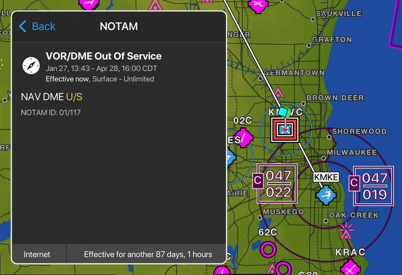
NAVAID NOTAMs are displayed as a graphical overlay on the map or chart to assist in navigation. The NOTAMs are displayed using the applicable NAVAID symbol, which are color-coded using the following classification:
- Red – Out of Service or Withdrawn
- Orange – Limitations
NAVAID NOTAMs that will become active in the future are displayed in yellow, and the upcoming visibility range is configurable between 3 and 48 hours.
To view NAVAID NOTAMS:
- From the Map or Flight Plan page, select Overlays from the map layer icon
- Select NOTAMs to enable the overlay
- Use the Radial Menu and select the NOTAM segment for more information
NOTAMs may also be viewed by selecting the NOTAMs widget in split screen mode.
NOTAM Overlay Filtering
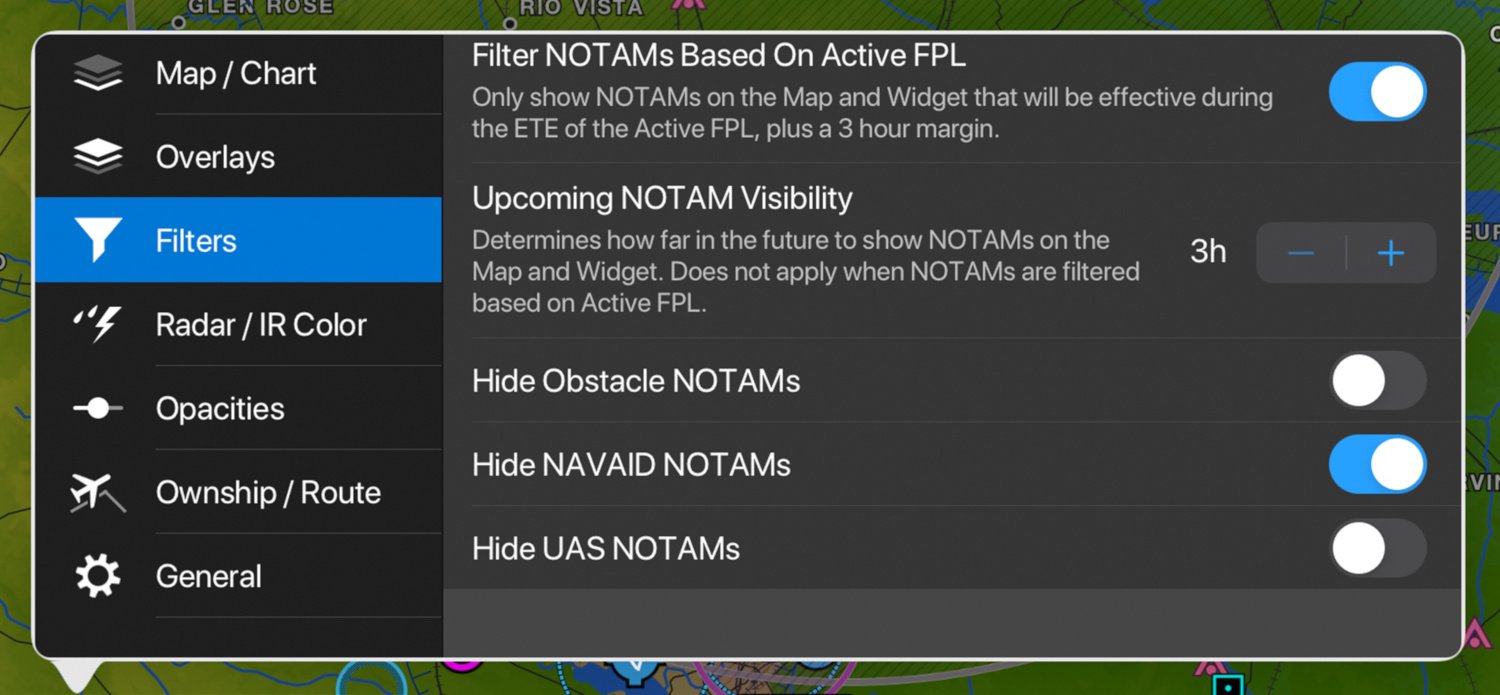
To date, the NOTAM overlay has displayed airspace, obstacle and UAS NOTAMs simultaneously. Based upon user feedback, we have added the ability to hide the Obstacle, NAVIAD or UAS NOTAM overlay, as desired.
To filter NOTAMS:
- From the Map or Flight Plan page, select Filters from the map layer icon
- Enable the filter to Hide Obstacle, NAVAID or UAS NOTAMs
Leidos Graphical Weather Briefing
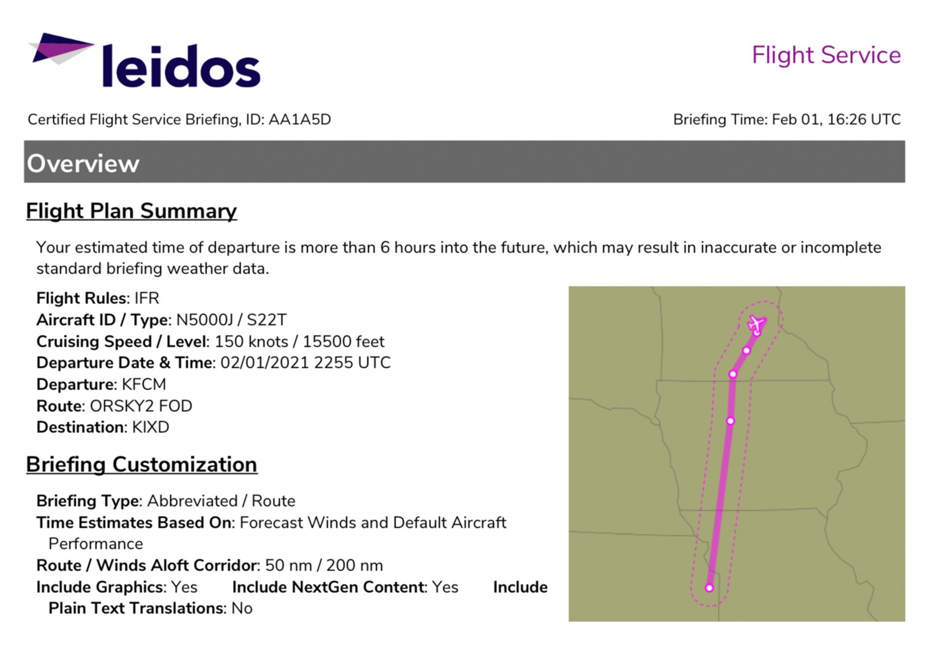
Garmin Pilot subscribers in US and Canada may now access the Leidos Flight Service graphical weather briefing. This next generation weather briefing includes all required aeronautical information and meteorological data provided by a specialist at 1/800-WXBRIEF.
To view the Leidos graphical weather briefing.
- Select Brief from the header on the Trip Planning page
- Tap the Share icon to annotate, email or print the briefing
Microsoft Flight Simulator 2020 Support
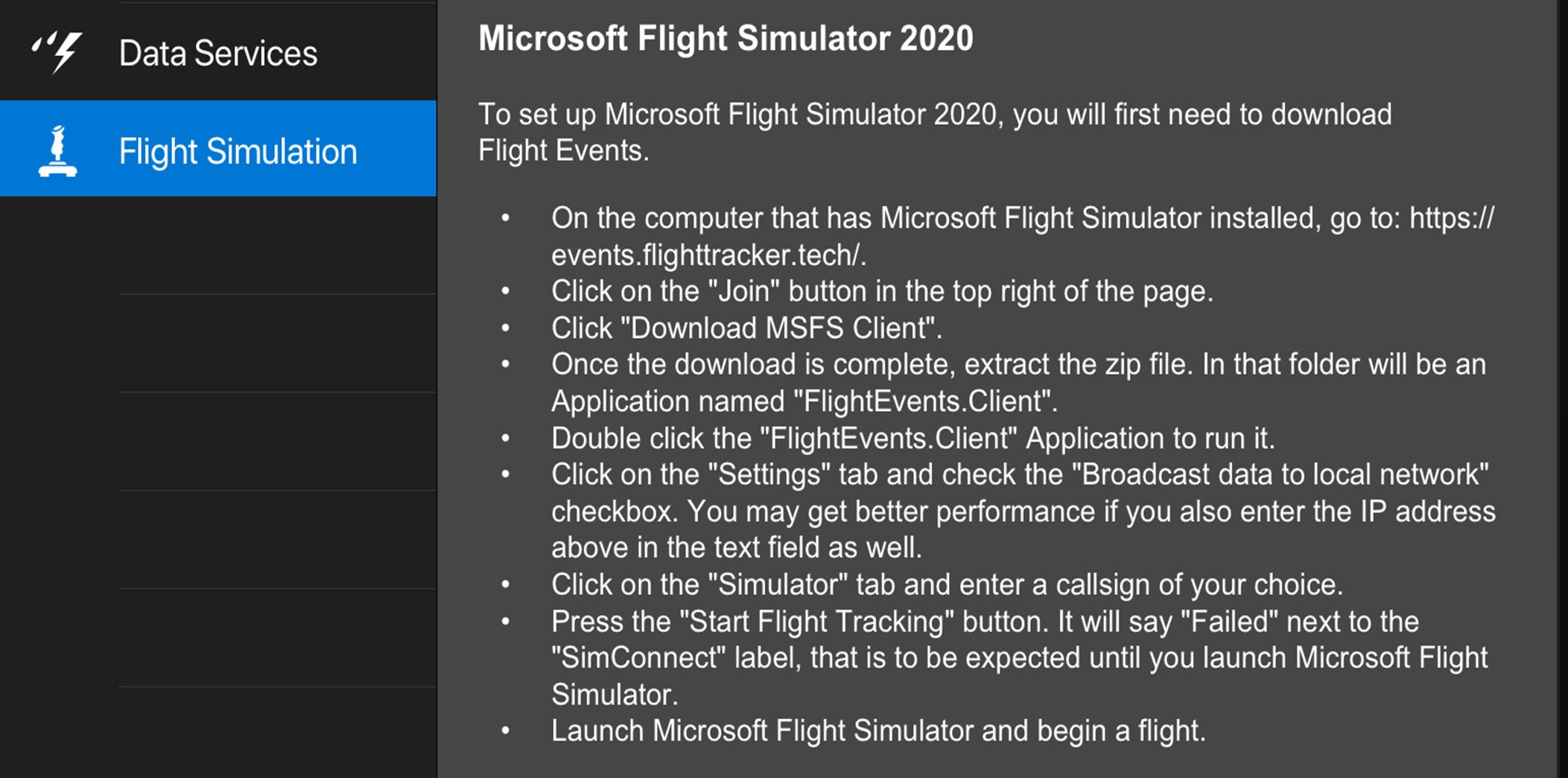
Garmin Pilot may be used in conjunction with Microsoft Flight Simulator 2020 to display GPS position data, moving map and other flight parameters.
To setup Microsoft Flight Simulator 2020, there is some setup required.
- Select Settings and tap the Flight Simulation tab
- Follow the instructions to download the FlightEvents
- Enable the “Use Flight Simulator Data” switch in Garmin Pilot to establish the connection to the simulator.
- The flight simulator Status indication in Garmin Pilot will change to “Receiving Data” once the connection is successful.